


What you need to know
Map of Mumbai- India

Mumbai is the capital city of the Indian state of Maharashtra. It is the most populous city in India and the ninth most populous agglomeration in the world, with an estimated city population of 18.4 million. Along with the neighbouring regions of the Mumbai Metropolitan Region, it is one of the most populous urban regions in the world and the second most populous metropolitan area in India, with a population of 20.7 million as of 2011. Mumbai lies on the west coast of India and has a deep natural harbour. In 2008, Mumbai was named an alpha world city. It is also the wealthiest city in India, and has the highest GDP of any city in South, West, or Central Asia. Mumbai has the highest number of billionaires and millionaires among all cities in India.
The seven islands that came to constitute Mumbai were home to communities of fishing colonies. For centuries, the islands were under the control of successive indigenous empires before being ceded to the Portuguese and subsequently to the British East India Company when in 1661 King Charles II married the Portuguese Catherine of Braganza, and as part of her dowry Charles received the ports of Tangier and seven islands of Bombay. During the mid-18th century, Bombay was reshaped by the Hornby Vellard project, which undertook reclamation of the area between the seven islands from the sea. Along with construction of major roads and railways, the reclamation project, completed in 1845, transformed Bombay into a major seaport on the Arabian Sea. Bombay in the 19th century was characterised by economic and educational development. During the early 20th century it became a strong base for the Indian independence movement. Upon India’s independence in 1947 the city was incorporated into Bombay State. In 1960, following the Samyukta Maharashtra movement, a new state of Maharashtra was created with Bombay as the capital.
Mumbai is the financial, commercial and entertainment capital of India. It is also one of the world’s top ten centres of commerce in terms of global financial flow,generating 6.16{ddb412a037644f8bc0ac3f8f88586c00ac97ce11cce6d16173a4a80ae89d28e5} of India’s GDP and accounting for 25{ddb412a037644f8bc0ac3f8f88586c00ac97ce11cce6d16173a4a80ae89d28e5} of industrial output, 70{ddb412a037644f8bc0ac3f8f88586c00ac97ce11cce6d16173a4a80ae89d28e5} of maritime trade in India (Mumbai Port Trust and JNPT), and 70{ddb412a037644f8bc0ac3f8f88586c00ac97ce11cce6d16173a4a80ae89d28e5} of capital transactions to India’s economy. The city houses important financial institutions such as the Reserve Bank of India, the Bombay Stock Exchange, the National Stock Exchange of India, the SEBI and the corporate headquarters of numerous Indian companies and multinational corporations. It is also home to some of India’s premier scientific and nuclear institutes like BARC, NPCL, IREL, TIFR, AERB, AECI, and the Department of Atomic Energy. The city also houses India’s Hindi (Bollywood) and Marathi film and television industry. Mumbai’s business opportunities, as well as its potential to offer a higher standard of living, attract migrants from all over India, making the city a melting pot of many communities and cultures.
Population
How Many People Live in Mumbai?
21,690,000
Mumbai, also called Bombay, is the capital city of the state of Maharashtra in India, and it’s the most populous city in India. As the 4th most populous city in the world and one of the populous urban regions in the world, Mumbai has a metro population of about 20.7 million in 2016.
Mumbai’s urban population is estimated to be over 22 million, and the densely populated city is one of the largest in India in terms of population, trade activity and business. The metropolitan area has experienced an explosion in growth over the past 20 years, a common occurrence with metropolitan areas in India.
Language
The official languages of India are English and Hindi and most people understand at least some of either language, or a blend of both known as “Hinglish”. Marathi is also the official language of the Mumbai and the state of Maharashtra, and is spoken widely in the city.
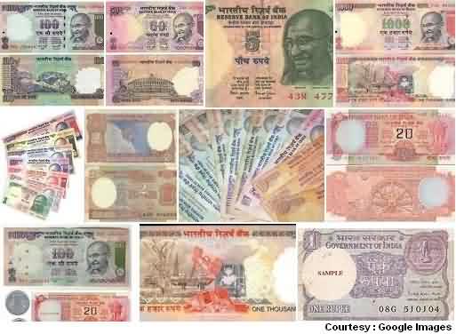
Currency
The Indian monetary unit is the Rupee (Rs. or INR), which can be divided into 100 Paise.
Geography
Mumbai consists of two distinct regions: Mumbai City district and Mumbai Suburban district, which form two separate revenue districts of Maharashtra. The city district region is also commonly referred to as the Island City or South Mumbai. The total area of Mumbai is 603.4 km2 (233 sq mi). Of this, the island city spans 67.79 km2 (26 sq mi), while the suburban district spans 370 km2 (143 sq mi), together accounting for 437.71 km2 (169 sq mi) under the administration of Municipal Corporation of Greater Mumbai (MCGM). The remaining areas belong to various Defence establishments, the Mumbai Port Trust, the Atomic Energy Commission and the Borivali National Park, which are out of the jurisdiction of the MCGM. The Mumbai Metropolitan Region which includes portions of Thane, Palghar and Raigad districts in addition to Greater Mumbai, covers an area of 4,355 km2 (1681.5 sq mi).
Mumbai lies at the mouth of the Ulhas River on the western coast of India, in the coastal region known as the Konkan. It sits on Salsette Island (Sashti Island), which it partially shares with the Thane district. Mumbai is bounded by the Arabian Sea to the west. Many parts of the city lie just above sea level, with elevations ranging from 10 m (33 ft) to 15 m (49 ft); the city has an average elevation of 14 m (46 ft). Northern Mumbai (Salsette) is hilly, and the highest point in the city is 450 m (1,476 ft) at Salsette in the Powai–Kanheri ranges. The Sanjay Gandhi National Park (Borivali National Park) is located partly in the Mumbai suburban district, and partly in the Thane district, and it extends over an area of 103.09 km2 (39.80 sq mi).
Apart from the Bhatsa Dam, there are six major lakes that supply water to the city: Vihar, Lower Vaitarna, Upper Vaitarna, Tulsi, Tansa and Powai. Tulsi Lake and Vihar Lake are located in Borivili National Park, within the city’s limits. The supply from Powai Lake, also within the city limits, is used only for agricultural and industrial purposes. Three small rivers, the Dahisar River, Poinsar (or Poisar) and Ohiwara (or Oshiwara) originate within the park, while the polluted Mithi River originates from Tulsi Lake and gathers water overflowing from Vihar and Powai Lakes. The coastline of the city is indented with numerous creeks and bays, stretching from the Thane creek on the eastern to Madh Marve on the western front. The eastern coast of Salsette Island is covered with large mangrove swamps, rich in biodiversity, while the western coast is mostly sandy and rocky.
Soil cover in the city region is predominantly sandy due to its proximity to the sea. In the suburbs, the soil cover is largely alluvial and loamy. The underlying rock of the region is composed of black Deccan basalt flows, and their acidic and basic variants dating back to the late Cretaceous and early Eocene eras. Mumbai sits on a seismically active zone owing to the presence of 23 fault lines in the vicinity.The area is classified as a Seismic Zone III region, which means an earthquake of up to magnitude 6.5 on the Richter magnitude scale may be expected.
Climate
Mumbai has a tropical climate, specifically a tropical wet and dry climate (Aw) under the Köppen climate classification, with seven months of dryness and peak of rains in July.The cooler season from December to February is followed by the summer season from March to June. The period from June to about the end of September constitutes the south-west monsoon season, and October and November form the post-monsoon season.
Between June and September, the south west monsoon rains lash the city. Pre-monsoon showers are received in May. Occasionally, north-east monsoon showers occur in October and November. The maximum annual rainfall ever recorded was 3,452 mm (136 in) for 1954. The highest rainfall recorded in a single day was 944 mm (37 in) on 26 July 2005. The average total annual rainfall is 2,146.6 mm (85 in) for the Island City, and 2,457 mm (97 in) for the suburbs.
The average annual temperature is 27.2 °C (81 °F), and the average annual precipitation is 2,167 mm (85 in). In the Island City, the average maximum temperature is 31.2 °C (88 °F), while the average minimum temperature is 23.7 °C (75 °F). In the suburbs, the daily mean maximum temperature range from 29.1 °C (84 °F) to 33.3 °C (92 °F), while the daily mean minimum temperature ranges from 16.3 °C (61 °F) to 26.2 °C (79 °F). The record high is 42.2 °C (108 °F) set on 14 April 1952, and the record low is 7.4 °C (45 °F) set on 27 January 1962.
Culture
Mumbai’s culture is a blend of traditional festivals, food, music, and theatres. The city offers a cosmopolitan and diverse lifestyle with a variety of food, entertainment, and night life, available in a form and abundance comparable to that in other world capitals. Mumbai’s history as a major trading centre has led to a diverse range of cultures, religions, and cuisines coexisting in the city. This unique blend of cultures is due to the migration of people from all over India since the British period.
Mumbai is the birthplace of Indian cinema—Dadasaheb Phalke laid the foundations with silent movies followed by Marathi talkies—and the oldest film broadcast took place in the early 20th century. Mumbai also has a large number of cinema halls that feature Bollywood, Marathi and Hollywood movies. The Mumbai International Film Festival and the award ceremony of the Filmfare Awards, the oldest and prominent film awards given for Hindi film industry in India, are held in Mumbai. Despite most of the professional theatre groups that formed during the British Raj having disbanded by the 1950s, Mumbai has developed a thriving “theatre movement” tradition in Marathi, Hindi, English, and other regional languages.
Transport
Public transport
Main article: Public transport in Mumbai
Public transport systems in Mumbai include the Mumbai Suburban Railway, Monorail, Metro, Brihanmumbai Electric Supply and Transport (BEST) buses, black-and-yellow meter taxis, auto rickshaws and ferries. Suburban railway and BEST bus services together accounted for about 88{ddb412a037644f8bc0ac3f8f88586c00ac97ce11cce6d16173a4a80ae89d28e5} of the passenger traffic in 2008. Auto rickshaws are allowed to operate only in the suburban areas of Mumbai, while taxis are allowed to operate throughout Mumbai, but generally operate in South Mumbai. Taxis and rickshaws in Mumbai are required by law to run on compressed natural gas (CNG),[208] and are a convenient, economical, and easily available means of transport.
Rail
The Mumbai Suburban Railway, popularly referred to as Locals forms the backbone of the city’s transport system. It is operated by the Central Railway and Western Railway zones of the Indian Railways. Mumbai’s suburban rail systems carried a total of 6.3 million passengers every day in 2007. Trains are overcrowded during peak hours, with nine-car trains of rated capacity 1,700 passengers, actually carrying around 4,500 passengers at peak hours.The Mumbai rail network is spread at an expanse of 319 route kilometres. 191 rakes (train-sets) of 9 car and 12 car composition are utilised to run a total of 2,226 train services in the city.
The Mumbai Monorail and Mumbai Metro have been built and are being extended in phases to relieve overcrowding on the existing network. The Monorail opened in early February 2014.The first line of the Mumbai Metro opened in early June 2014.
Mumbai is the headquarters of two zones of the Indian Railways: the Central Railway (CR) headquartered at Chhatrapati Shivaji Terminus (formerly Victoria Terminus), and the Western Railway (WR) headquartered at Churchgate. Mumbai is also well connected to most parts of India by the Indian Railways. Long-distance trains originate from Chhatrapati Shivaji Terminus, Dadar, Lokmanya Tilak Terminus, Mumbai Central, Bandra Terminus, Andheri and Borivali.
Bus
Mumbai’s bus services carried over 5.5 million passengers per day in 2008, which dropped to 2.8 million in 2015. Public buses run by BEST cover almost all parts of the metropolis, as well as parts of Navi Mumbai, Mira-Bhayandar and Thane. The BEST operates a total of 4,608 buses with CCTV cameras installed, ferrying 4.5 million passengers daily over 390 routes. Its fleet consists of single-decker, double-decker, vestibule, low-floor, disabled-friendly, air-conditioned and Euro III compliant diesel and compressed natural gas powered buses. BEST introduced air-conditioned buses in 1998. BEST buses are red in colour, based originally on the Routemaster buses of London. Maharashtra State Road Transport Corporation (MSRTC, also known as ST) buses provide intercity transport connecting Mumbai with other towns and cities of Maharashtra and nearby states. The Navi Mumbai Municipal Transport (NMMT) and Thane Municipal Transport (TMT) also operate their buses in Mumbai, connecting various nodes of Navi Mumbai and Thane to parts of Mumbai.
Buses are generally favoured for commuting short to medium distances, while train fares are more economical for longer distance commutes.
The Mumbai Darshan is a tourist bus service which explores numerous tourist attractions in Mumbai. Bus Rapid Transit System (BRTS) lanes have been planned throughout Mumbai. Though 88{ddb412a037644f8bc0ac3f8f88586c00ac97ce11cce6d16173a4a80ae89d28e5} of the city’s commuters travel by public transport, Mumbai still continues to struggle with traffic congestion. Mumbai’s transport system has been categorised as one of the most congested in the world.
Water
Water transport in Mumbai consists of ferries, hovercrafts and catamarans. Services are provided by both government agencies as well as private partners. Hovercraft services plied briefly in the late 1990s between the Gateway of India and CBD Belapur in Navi Mumbai. They were subsequently scrapped due to lack of adequate infrastructure.
Road
Mumbai is served by National Highway 3, National Highway 4, National Highway 8, National Highway 17 and National Highway 222 of India’s National Highways system. The Mumbai-Pune Expressway was the first expressway built in India. The Eastern Freeway was opened in 2013. The Mumbai Nashik Expressway, Mumbai-Vadodara Expressway, are under construction. The Bandra-Worli Sea Link bridge, along with Mahim Causeway, links the island city to the western suburbs. The three major road arteries of the city are the Eastern Express Highway from Sion to Thane, the Sion Panvel Expressway from Sion to Panvel and the Western Express Highway from Bandra to Dahisar. Mumbai has approximately 1,900 km (1,181 mi) of roads.There are five tolled entry points to the city by road.
Mumbai had about 721,000 private vehicles as of March 2014, 56,459 black and yellow taxis as of 2005, and 106,000 auto rickshaws, as of May 2013.
Air
The Chhatrapati Shivaji International Airport (formerly Sahar International Airport) is the main aviation hub in the city and the second busiest airport in India in terms of passenger traffic. It handled 36.6 million passengers and 694,300 tonnes of cargo during FY 2014–2015. An upgrade plan was initiated in 2006, targeted at increasing the capacity of the airport to handle up to 40 million passengers annually and the new terminal T2 was opened in February 2014.
The proposed Navi Mumbai International Airport to be built in the Kopra-Panvel area has been sanctioned by the Indian Government and will help relieve the increasing traffic burden on the existing airport.
The Juhu Aerodrome was India’s first airport, and now hosts the Bombay Flying Club and a heliport operated by state-owned Pawan Hans.
Sea
Mumbai is served by two major ports, Mumbai Port Trust and Jawaharlal Nehru Port Trust, which lies just across the creek in Navi Mumbai. Mumbai Port has one of the best natural harbours in the world, and has extensive wet and dry dock accommodation facilities. Jawaharlal Nehru Port, commissioned on 26 May 1989, is the busiest and most modern major port in India. It handles 55–60{ddb412a037644f8bc0ac3f8f88586c00ac97ce11cce6d16173a4a80ae89d28e5} of the country’s total containerised cargo. Ferries from Ferry Wharf in Mazagaon allow access to islands near the city.
The city is also the headquarters of the Western Naval Command, and also an important base for the Indian Navy.